Preparing Exploration
Featuring a Hike in Monte Bello
By Neil Wiley · August 2026 · Volume MMXXVI, Number 8 · Page 18 · 4 min read
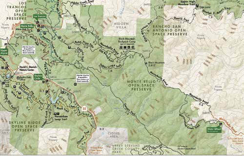
To prepare for my solo hike in Monte Bello Open Space Preserve, I read several articles that detailed the environment of the preserve, including maps and text from the MidPen Regional Open Space website and brochures. I also read a detailed article in 101 Great Hikes in the San Francisco Bay Area by Ann Marie Brown.
I assembled directions and maps on paper and my cell phone, put a safety chain around my neck for my safety communications service, and shared the details with my next- door neighbor, who could follow my trail. He knew where I was, when I would return, and who to call.
When you are out in a large preserve, you need to take care of yourself. I bring a hat, two bottles of water, some heathy snacks, a small safety kit, map, flashlight, extra camera batteries, and extra SD cards. (On this hike my cell phone died, so next time I’ll be carrying a small battery charger.) I recently added a camera harness to keep my hands free.
On hikes in rough terrains, I might use walking sticks, but they get in the way when you are using a camera. Why do you care what this old man carried? I met six people on this hike. Not one was prepared. They had no water, no food, and some had no map. None had a backup.
This hike was only 5.5 miles long, but it could seem a lot longer if you are lost, hurt, or very tired. A little preparation makes hiking a safer and more enjoyable experience. The hike. Monte Bello is my new favorite preserve because of the beautiful scenery. It is also a challenge with a long trek up to Black Mountain.
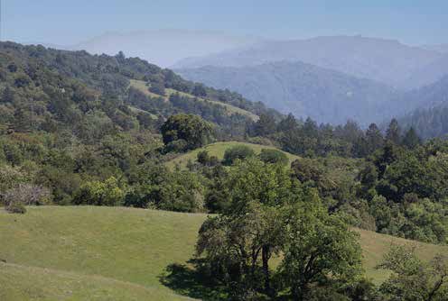
My exploration began with a challenging drive up narrow and curvy Black Road, followed by a ride on my favorite highway (Skyline Boulevard) to a right turn on Page Mill Road. Drive east for 1.7 miles to the preserve entrance on the right. Maps are available at a small stand. (Everyone should have their own map.) Follow a single-track trail down to a stone bench. It’s a great place to sit and enjoy a beautiful view of canyons and large hills. In the distance, you can see our local Mount Umunhum.
Look at your map and do a quick equipment check. You follow the left fork of the Nature Trail to a right on Canyon Trail and left on the narrow single-track Belle Vista Trail. This is where you may want to drink your water. There are views, but it is a continuous climb with little shade, and no room to rest or dodge the occasional biker. You’ll look forward to seeing the Old Ranch Road on the right at 1.3 miles that takes you to the Black Mountain Backpack Camp.
The camp offers a few concrete tables, a toilet full of flies, non-potable water, a
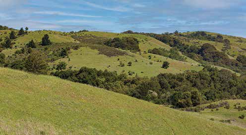
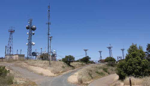
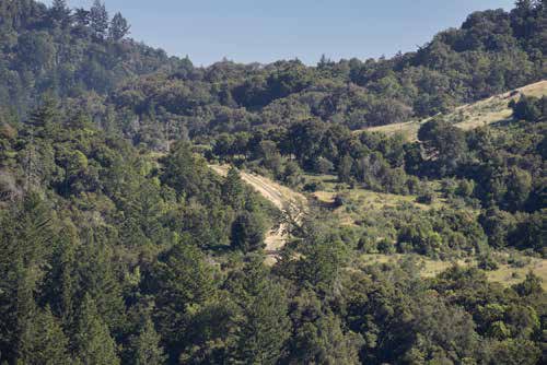
payphone, and best of all, shade and a place to restore. I finished my first bottle of water and some snacks. The site also offered some wildlife sightings, including a coyote who walked about ten feet away. When I barked at him, he glanced at me. I think he yawned and said: “You are not a dog.” Many small birds joined me. I think they were looking for Although the elevation gain was 1,093 feet and the total round trip was 5.5 miles, the hike up to Black Mountain summit was only 0.5 of a mile. Rest and food made the climb The summit displayed a giant cluster of microwave towers. To the east, you can see the entire San Francisco Peninsula, but your photos may suffer from blue haze. As a bonus, you can see the beautiful Stevens The way back is via a steep descent on the wide Indian Creek Trail where I met a young couple. The woman was surprised that an old man was on this hike. I was surprised that they were starting their climb near dark without water or food. I hope they made it to Walking down this wide trail offers views of giant buttes and deep canyons down to Canyon Trail, a left on Stevens Creek Nature Trail, and an easy climb along a stream and then up through grasslands back to the bench with a view and the preserve entrance, It is a great experience. My only victim was my failing cell phone. Be sure you monitor your phone, use multiple devices, or add a charger. When signage is good, you may not need on-line mapping, but it can help if you Enjoy exploring. Be prepared. If you have more helpful ideas to share, email me at